
OMaps
OMaps is an Orienteering Australia initiative to provide a Geographic Information System displaying contacts and locations of orienteering maps within Australia. Several of our maps can be found on this site.
Nillumbik Emus has a proud history of map production. Our maps have been used in National and State Championships: both mountain bike and foot orienteering. We also have several Park and Street maps.
Digitised Versions of Club Bush Maps
Permanent Courses
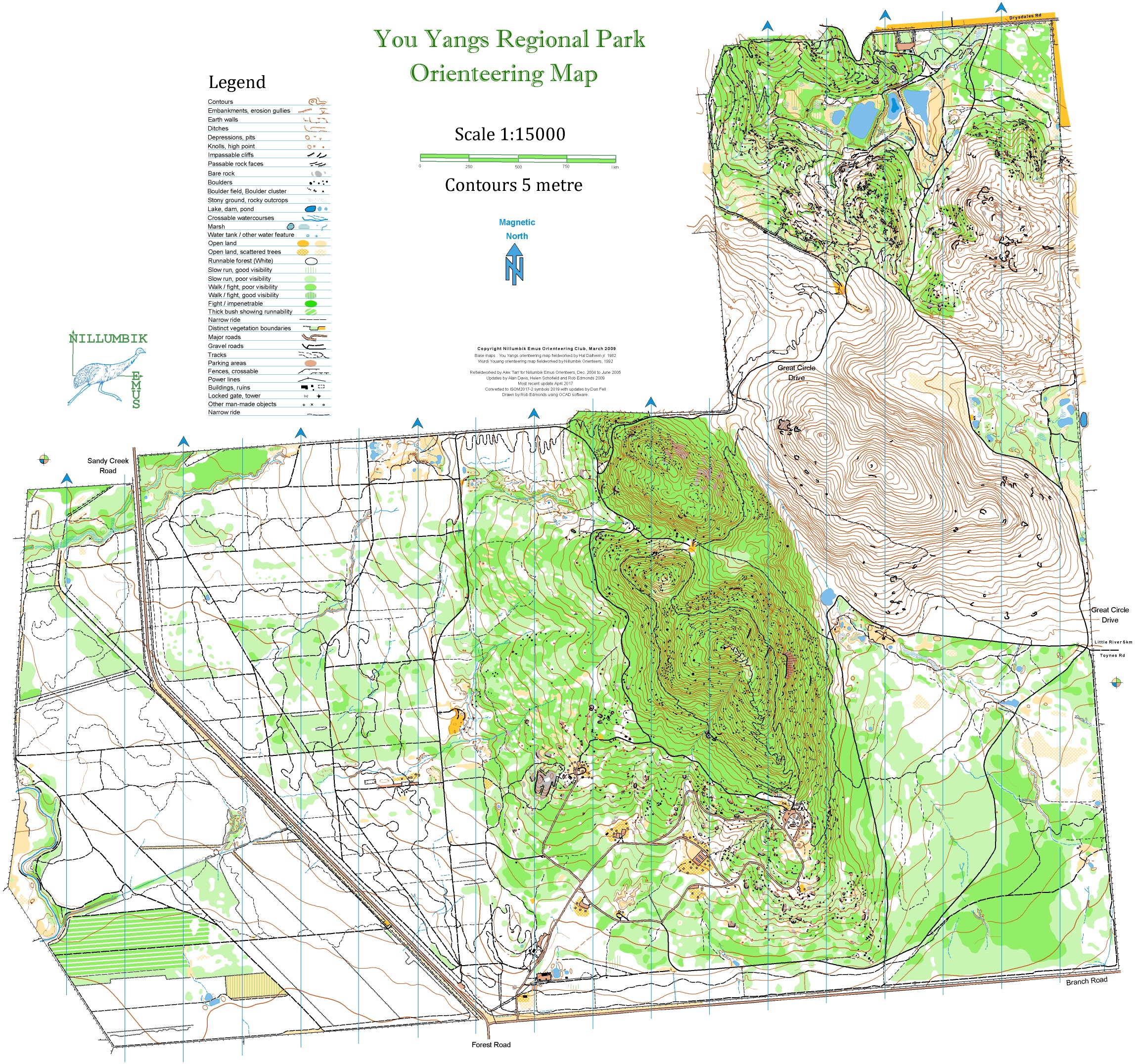
The club has two permanent courses at the You Yangs – the Branding Yard and Kurrajong.
Each map has 21 or 22 controls; map scale 1:12500 with 5m contours.
Punches are mounted on numbered white posts
Purchase maps and control cards from Orienteering Service of Australia or contact club for maps and control cards.
Maprun & DIY Maplink
Check out DIY Maplink on the OV website for a course near you. Download and print maps you want to use for a practice walk or run.
MapRun 6 is the App you use to find a map/course near you. It was especially helpful when COVID prevented regular events being held. It is now used at all Park/Street events.
It enables a form of Orienteering that uses a SmartPhone App for punching and timing, avoiding the need to put out flags and SI units on the course. It runs on Android or iOS.
This saves time and effort for organisers, courses can be left open for extended periods of time, and instant feedback is provided with track, personal result and leaderboard results in the App.
You Yangs Kurrajong , Diamond Creek and Eltham Lower Park courses are recent additions to MapRun 6.
The Whitehorse isoGaine is another map which runs on MapRun 6.

You must be logged in to post a comment.